


Dean
Dr C. Chavhunduka
Charles Chavhunduka is a Senior Lecturer and Dean in the Faculty of Engineering and the Built Environment at the University of Zimbabwe. He holds a PhD in Development Planning (University of Wisconsin-Madison), MSc Regional and Urban Planning, BA Honours Geography (University of Zimbabwe). External Examiner for the Department of Regional and Urban Planning, Great Zimbabwe University (GZU). He has served as a Chief Planning Officer in the Government of Zimbabwe and on several international projects in eastern and southern Africa, dealing with land governance and land use planning. Member of the Royal Town Planning Institute (RTPI) and the Zimbabwe Institute for Urban and Regional Planners (ZIRUP). He is the Editor-in Chief of the Journal of Urban Systems and Innovations for Resilience in Zimbabwe (JUSIRIZ) and a participating member of the Southern Africa Node under the Network of Excellence for Land Governance in Africa (NELGA). His research interests include sustainable urban and rural development, land policy and management and land readjustment.
Email: This email address is being protected from spambots. You need JavaScript enabled to view it., This email address is being protected from spambots. You need JavaScript enabled to view it.
Dean's statement
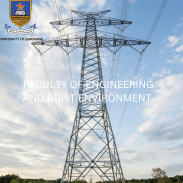
The Faculty of Engineering and the Built Environment will be known for the development and implementation of innovative built environment, manufacturing and engineering designs and systems driving modernisation and industrialisation. The Faculty will focus on moulding engineering and related professionals that will develop innovative and appropriate solutions for societal well-being within and beyond the country’s borders.
Vision
To be recognised as a leading centre that produces outstanding Engineering Professionals in the country and beyond our borders.
Mission
Our mission is to enable our clients and customers to make meaningful engineering contributions to sustainable development in Zimbabwe. To this end we provide high quality engineering education, training and advisory services on a needs oriented basis. We guarantee the above by maintaining excellence in Teaching, Learning, Research and Service to the Community.
Values
Knowledge, diligence, Integrity